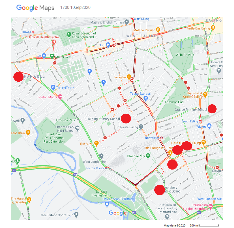
This is not an in-depth analysis but is there to highlight the areas where the increased pollution levels are.
The red Circles indicate the approximate School locations.
The circle at the top left location is where St Marks Primary school is located
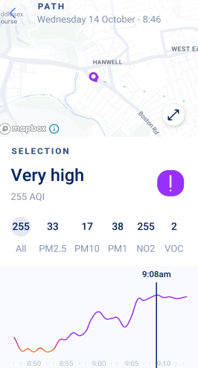
A local resident Plume Flow reading indicates extremely high levels of atmospheric pollutants
Of 133 2 bed Houses/Flats for sale below £375,000 77% are on the perimeter roads
Of 109 2 bed Houses/Flats to rent below a £2000pcm ceiling 67% were on the perimeter roads
The main concentration is on the Uxbridge road, Northfield Avenue and South Ealing road
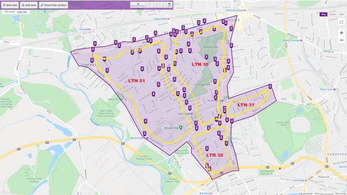
The majority of affordable housing is on the perimeter roads where the pollution is highest and now increased as a result of the LTNs
There is not sufficient pollution measuring equipment to monitor the effects of the LTNs on the perimeter roads. The ones that are in place are diffusion tubes which have monthly mean readings so are unable to pick up spikes in pollution as demonstrated above with the Plume Flow measurements.
It is the people who live on the perimeter roads who will suffer the most.
These are all residential roads some with shops and cafes located on them.